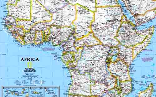
Physical Map of Africa


Interactive physical map with state borders, cities, shaded relief.
Africa is the second largest continent with a population of around 1 billion. Is the most underdeveloped region with the poorest countries in the World, but thanks to the massive foreign investments it has a fast growing economy.
This map includes
- State borders and capitals
- Primary and secondary cities
- Main roads and railroad system
- Major lakes and rivers
- Geographical informations
- Shaded relief
- Info about climate and terrain
- Insets with major islands
Order printed version of this map at maps.com.